


A Rainy Day at Mount Tamalpais
Photography meetup on a rainy day in Mount Tam 🌧️

I spent my Saturday afternoon hiking and taking photos at the place nobody knows how to pronounce properly: Mount Tamalpais, or Mount Tam. Mount Tam is the highest point in Marin County and is a protected public land along with Muir Woods. The origins of the name Tamalpais is unknown but it’s suggested that it comes from the Spanish name given to the indigenous people Tamal.
If you like the content, please consider sharing!
Drive Up
As with every SF Scoop roadtrip article, we always write about the drive up. Though only 20 miles away from North Beach, SF where I live, the drive itself took about an hour to reach the peak. We drove across the Golden Gate Bridge, through Sausalito, and cut around Muir Woods, all beautiful places that deserve their own articles.
Amidst the terrible weather and low fog visibility, Sunny was a baller on the wheel. Thanks for driving Sunny! We stopped by a couple of places along the road to take photos and eventually reached our destination: Mount Tamalpais Visitor Center.
Visitor Center & Fire Lookout
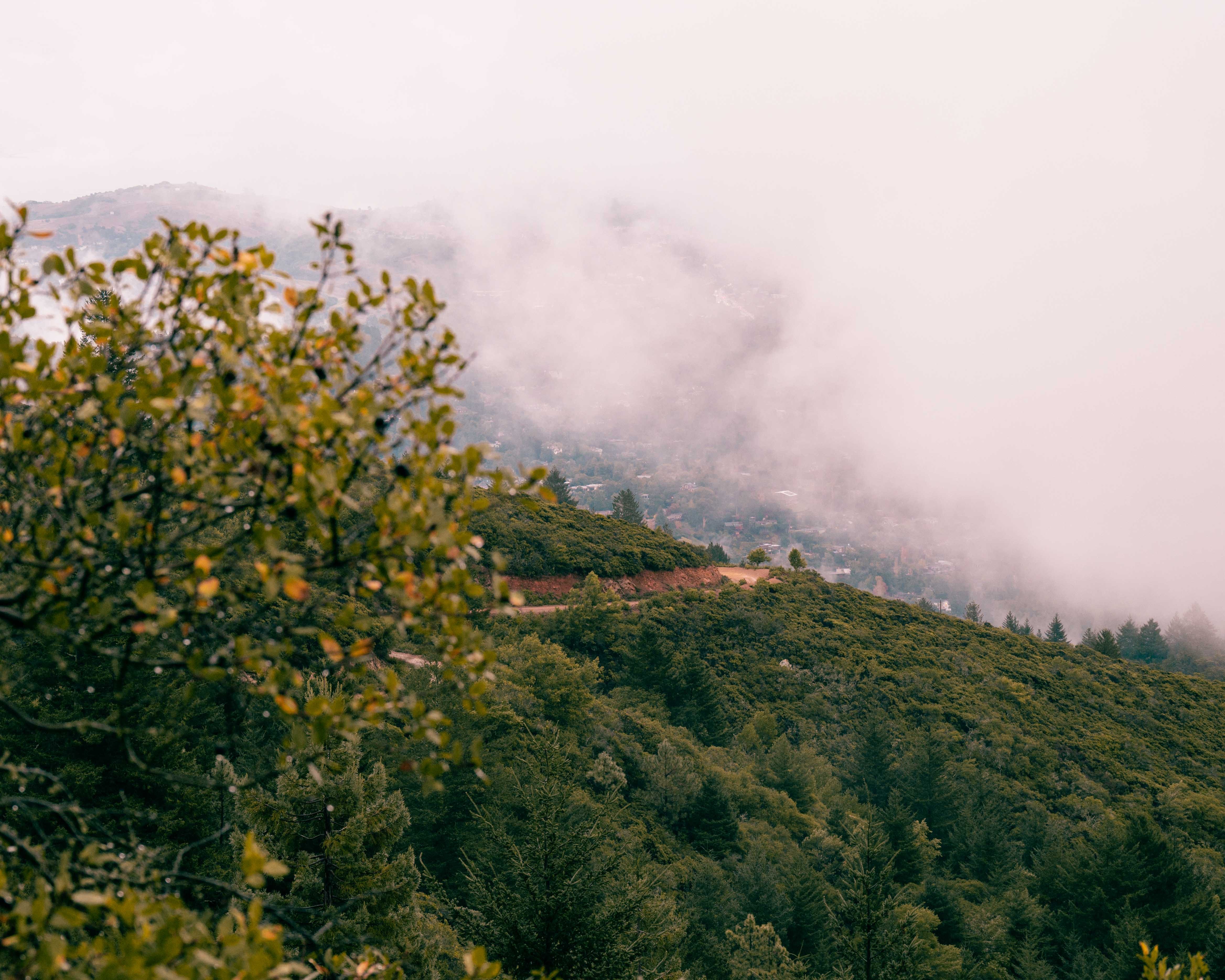
Mount Tamalpais Visitor Center is the highest point on Mount Tam that you can drive to. On a good day, you can usually see the entire Bay, San Francisco, and Oakland/Berkeley area. Sometimes you can catch the low fog that rolls through the city or lower areas of Mount Tam, a truly special sight. Our Saturday trip however, we were condemned to blindness being inside the fog.
Being inside the thick fog felt like I was looking at a blank sheet of paper everywhere I looked. We could probably see no more than 100 feet away from us. The view of the city and the bay was blocked and all you could see was the trail ahead of you. Nevertheless, we made the best of the situation, and the thick fog made for some unique photos.
The visitor center is the trailhead for three trails, we chose to climb the Verna Dunshee Trail to the “Fire” Lookout. If the view is fire, we had to go check it out. The hike itself was only 0.3 miles each way but took us much longer as we stopped every minute to take random photos. The lookout itself was quite interesting. It was a stone tower protected with Barb wire; it almost looked like a fortress. Equipped with electricity, a sewage and water system, and arguably the most beautiful view in California, the city should put up the Fire Lookout on AirBnb as a destination stay.

Sunset Hike
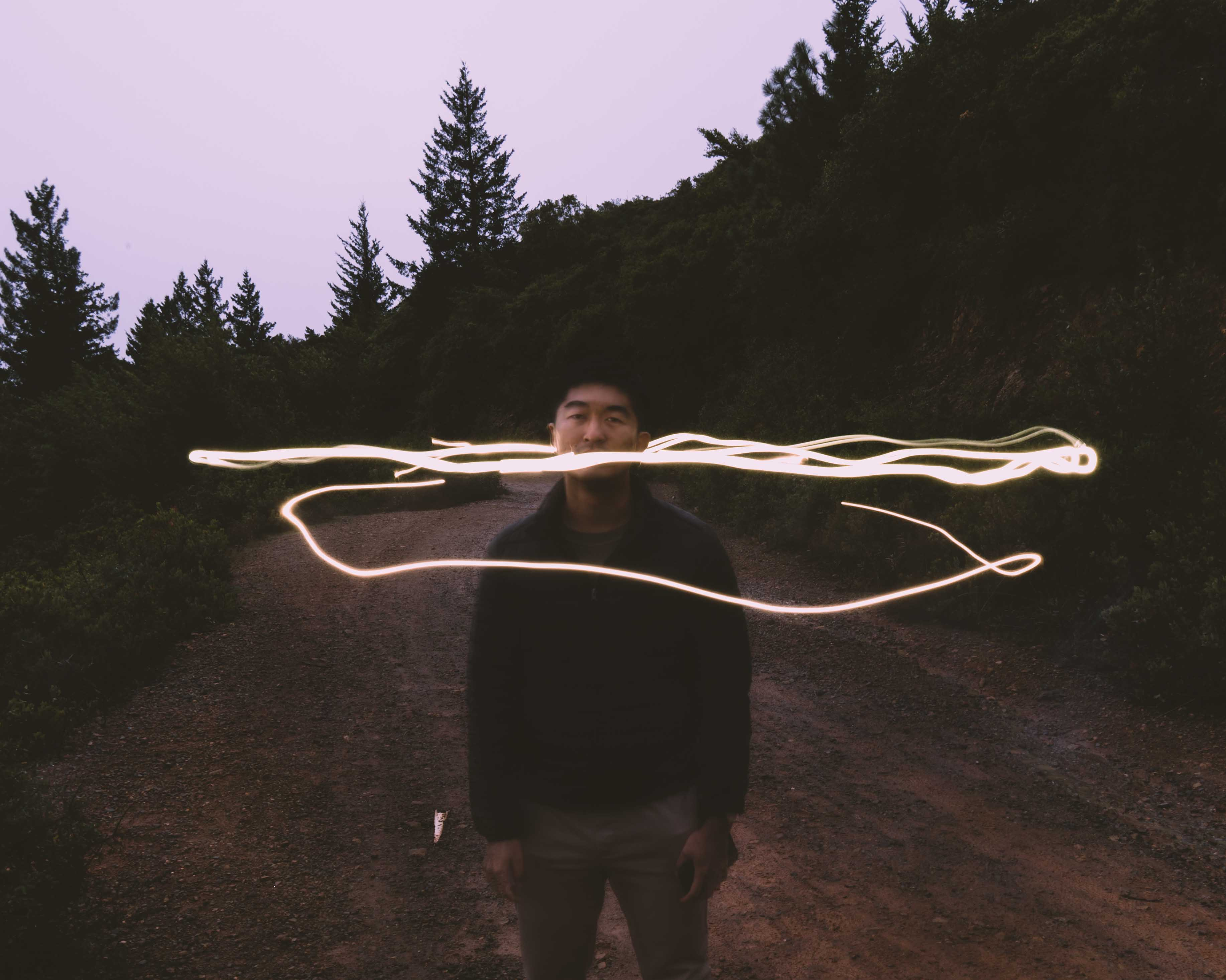
Verna Dunshee Trail was a too short, so we continued the exercise at Fern Creek Trail, the other trailhead that starts at the visitor center. The trail starts off going downhill through thick vegetation that leads you to a paved road. Once on the paved road, the hike is easy. The sky started to clear up and the sun began to set early in this winter season.
We thought it would be a great idea to try out long exposure photography. In long exposure photography, you’re able to capture light trails in motion. To do long exposure photography, you need a steady hand. Fortunately, Filip brought a tripod to do exactly this. We played around, capturing some long exposure shots of the moving fog. We also experimented with light trails using our phone flashlights. The photos turned out amazing!

Dinner at Bar Bocce
Sunny recommended Bar Bocce, an Italian style restaurant in Sausalito, for dinner. The place had an outdoor fireplace with a gorgeous view of the city and the bay. Would highly recommend their artichoke pizza!